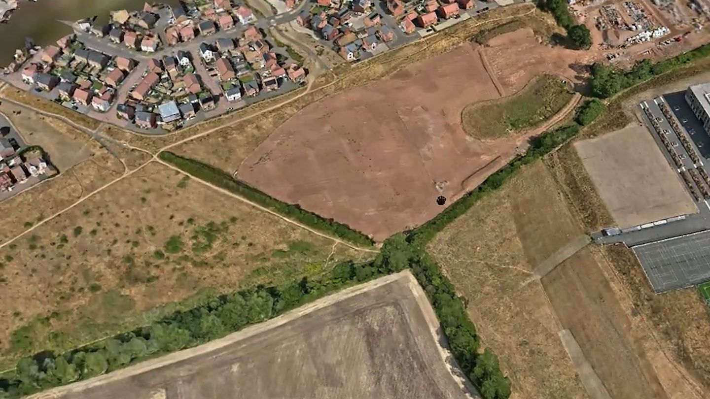
What is drone mapping?
We fly the whole site in a planned pattern and capture overlapping aerial photos, which are processed using photogrammetry into one detailed, measurable 3D model of the land, buildings and surroundings.
The model is hosted online, so you and your team can explore it from any device, measure distances, areas and slopes, and share the link with consultants and contractors. You can also download the point cloud and OBJ files for your own software.
It's a fast way to understand a site before you plan anything: where the land rises and falls, where access is tight, and how buildings, roads and boundaries fit together.
What you receive
- Measurable online 3D model of the whole site
- Downloadable point cloud and OBJ files
- Distances, areas and slopes from your desk
- Delivered within 5 working days
Who it's for
- Developers and planning teams
- Contractors preparing a new site
- Land agents, farms and estates
- Campuses and multi-building sites
- Facilities and estates managers
Why use a drone
- Pre-development planning: see the lie of the land
- Share one model with every consultant and contractor
- Plan extensions and new development
- Plan traffic routing, parking and public access
- Plan road closures and site logistics
- Support for planning applications
Proof
Mini case study: Tachbrook Park
Pre-site mapping of a whole site being developed into a country park, so the client could see the lie of the land and share it with contractors. Open the model to explore it yourself.
How it works
From first call to finished files.
Enquiry & quote
Tell us the site address and what you need. We send a fixed quote.
Checks & dates
Site access and flight restrictions checked, dates agreed, often with a backup date.
Capture
A risk assessment on the day, then a careful, controlled flight.
Process
Photos, video and 3D models processed and checked before release.
Deliver
Shareable links and files within 5 working days, often in 2 to 3. Invoice on delivery, 30-day terms.
CAA qualified
GVC, Operational Authorisation in the Specific category, and A2 CofC.
Insured
£5m public liability insurance plus professional indemnity.
Experienced
30 years in photography and flying drones since 2015.
Nationwide
Based in Lichfield, working across the Midlands and the UK.
FAQs
Drone mapping, answered.
Still got a question? Call Mark on 07866 522549.
What do I get from drone mapping?
A measurable online 3D model of your land or site, which you can explore, measure and share with a link, plus downloadable point cloud and OBJ files for your own software.
How much does drone mapping cost?
Mapping is quoted per job, as it depends on the size of the site and the time needed to fly it. Tell us the site address and what you need, and we'll send a fixed quote.
How big an area can you map?
Anything from a single plot or field to a campus, estate or development site with multiple buildings.
Can I share the model with contractors?
Yes. The model is hosted online, so anyone you send the link to can open it in a web browser, with no software to install.
Is drone mapping the same as a topographic survey?
No. We capture a measurable 3D model and point cloud of the site. If you need a formal topographic survey drawing, your surveyor can work alongside our data.
How quickly will I get the model?
Mapping models are delivered within 5 working days, and often sooner.
What happens if the weather is bad?
We can't fly in rain or high wind. We watch the forecast, often agree a backup date up front, and let you know before we travel if the date needs to move.
Related services
Often booked together.
Get a quote
Talk to Mark about your site.
Share the site address and what you need. Mark will come back with the right approach and a fixed price, usually within one working day. Prefer to talk? Call 07866 522549.
- Phone
- 07866 522549
- mark@markzaccariaphotography.co.uk
- Based
- Lichfield, Staffordshire
- Member
- Greater Birmingham Chamber of Commerce