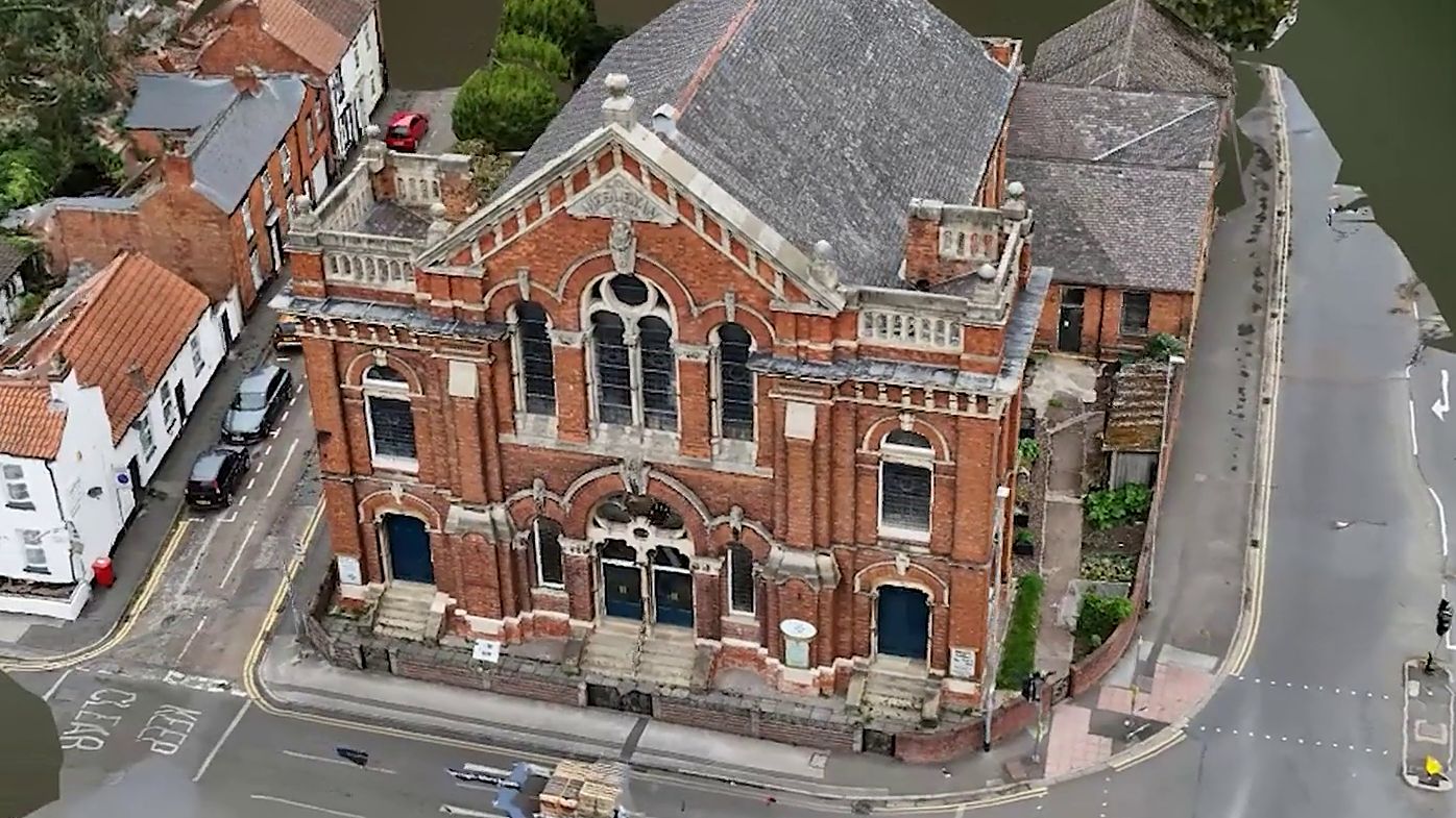
Drag to spin the model, scroll to zoom. Open it full screen.
What is a digital twin?
We fly an RTK-equipped drone around the building or site and capture thousands of overlapping photos. These are processed, using photogrammetry, into one measurable 3D model hosted online. Open the link on any device and you can look at every part of the building from any angle.
You can measure straight from the model: point to point, vertical and horizontal lines, slopes, roof pitches, angles and areas. Everything is included in the price: the shareable online model, downloadable point cloud and OBJ files, and photos and video.
Surveyors also combine our exterior model and point cloud with their own interior LiDAR scans to get the whole building inside and out. If you need interior capture too, we can bring in trusted LiDAR partners or provide a Matterport-style interior walkthrough.
3D model or photo inspection?
A photo and video inspection gives very similar coverage and may cost a little less. A 3D model lets you explore every angle and take measurements, and it can be shared with everyone involved in the project. If you're not sure which you need, give Mark a call and he'll talk you through it.
What you receive
- Shareable, measurable online 3D model
- Downloadable point cloud and OBJ files
- Photos and video of the building
- Delivered within 5 working days, often in 2 to 3
Who it's for
- Facilities and estates managers
- Solar and lightning protection installers
- Heritage owners and conservation teams
- Architects and surveyors
- Schools, colleges and campuses
- Contractors planning access
Why use a drone
- Plan solar installations, roof repairs and lightning protection
- Contractors check access, cherry picker and scaffold positions from their desk
- Skip the pre-start site visit
- Condition records, insurance claims and planning applications
- Heritage records and design work
- Whole sites: development, traffic, parking and public access planning
Proof
Case study: National Trust, Charlecote Park
- The need
- Planning a lightning conductor installation on a historic property.
- What we did
- A full, high-detail 3D model of the property, delivered within a few days.
- The result
- The installer could see the access and requirements, decide where the conductor would go and measure exactly how much material they needed before anyone got to site. Their time on site was cut in half, halving their costs for that job.
“Mark has been an invaluable asset to our team, consistently delivering exceptional results and demonstrating a genuine passion for his craft. We look forward to continuing our partnership with him for all our future aerial endeavours.”
Explore example models
How it works
From first call to finished files.
Enquiry & quote
Tell us the site address and what you need. We send a fixed quote.
Checks & dates
Site access and flight restrictions checked, dates agreed, often with a backup date.
Capture
A risk assessment on the day, then a careful, controlled flight.
Process
Photos, video and 3D models processed and checked before release.
Deliver
Shareable links and files within 5 working days, often in 2 to 3. Invoice on delivery, 30-day terms.
CAA qualified
GVC, Operational Authorisation in the Specific category, and A2 CofC.
Insured
£5m public liability insurance plus professional indemnity.
Experienced
30 years in photography and flying drones since 2015.
Nationwide
Based in Lichfield, working across the Midlands and the UK.
FAQs
3D building models and digital twins, answered.
Still got a question? Call Mark on 07866 522549.
What is a digital twin?
A digital twin is an accurate, measurable 3D copy of a building or site, made from thousands of overlapping drone photos. You view it online, spin it, zoom in and take measurements, and share it with anyone using a link.
How accurate is a drone 3D model?
Our 3D models are accurate to within 5 cm and detailed enough to pick out individual bricks.
How much does a 3D building model cost?
3D models start from £400 + VAT. That includes the shareable online model, downloadable point cloud and OBJ files, and photos and video. Larger buildings and whole sites are quoted per job.
How long does it take?
Models are always delivered within 5 working days, and often in 2 to 3.
What can I measure?
Point-to-point distances, vertical and horizontal lines, slopes, roof pitches, angles and areas, all from your web browser.
Do I need special software?
No. The model opens in a normal web browser on any device. If your team uses their own 3D or CAD software, you can also download the point cloud and OBJ files.
Can you model a whole site or campus?
Yes. We model single buildings, multi-building sites, campuses and whole estates, including the National Trust at Charlecote Park. Whole-site models are popular for planning development, traffic routing, parking and public access.
Do you capture interiors?
Our drone 3D models capture the exterior. For interiors we offer Matterport-style walkthroughs, and we bring in trusted partners for interior LiDAR scanning when it's needed.
Related services
Often booked together.
Get a quote
Talk to Mark about a 3D model.
Share the site address and what you need. Mark will come back with the right approach and a fixed price, usually within one working day. Prefer to talk? Call 07866 522549.
- Phone
- 07866 522549
- mark@markzaccariaphotography.co.uk
- Based
- Lichfield, Staffordshire
- Member
- Greater Birmingham Chamber of Commerce